Die Wahrscheinlichkeit ist gross, dass es zwischen einem kleinen See im US-Bundesstaat Texas und der Zürcher Unterländer Gemeinde absolut keine Verbindung gibt. Ausser dem heute zufälligerweise gleich geschriebenen Namen.
Trotzdem oder gerade deshalb sei dieses Seelein hier erwähnt.

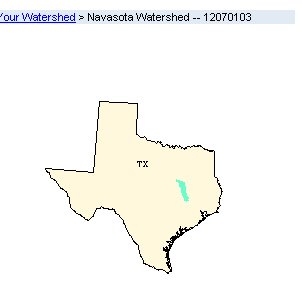
(Auf der von der Watershed site des U.S. Umweltbundesamtes kopierten Karte sieht man das hydrologische Einzugsgebiet zu dem Wyach Lake gehört.)
Die GNIS-Website (Geo Name Information System) des U.S. Geological Survey verzeichnet das Gewässer mit folgenden Eintrag:
Feature Name: Wyach Lake
Feature Type: lake
State: Texas
County: Robertson
USGS 7.5' x 7.5' Map: Camp Creek Lake
Latitude (nn°nn'nn''): 310200N
Longitude (nnn°nn'nn''): 0961521W

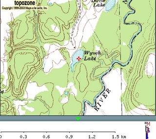
(Karte des U.S. Geological Survey mit Wyach Lake im Zentrum)
Beeindruckend ist, was unterhalb dieses Eintrags an Optionen aufgeführt ist. Eine Illustration des heutzutage online verfügbaren Kartenmaterials:
- TopoZone.com Display feature in TopoZone.
- Display FIPS55 Place Code Note: Not all place codes are available through this site. To search the FIPS55 database or download FIPS55 files, go to the FIPS55 site (FIPS? «FIPS55 ist the Federal Information Processing Standard (FIPS), which contains codes for named populated places, primary county divisions, and other locational entities of the United States and areas under the jurisdiction of the United States. FIPS55 data maintenance is the responsibility of the U.S. Geological Survey (USGS). Under the authority of the National Institute of Standards and Technology (NIST), the USGS is disseminating the data, and is the only Federal agency authorized by NIST to do so.»)
- View USGS Digital Raster Graphic (DRG) covering this feature from TerraServer. A DRG is a digitized version of a USGS topographic map. Visit the USGS Digital Backyard for more information.
- View USGS Digital Orthophoto Quadrangle (DOQ) covering this feature from TerraServer. A DOQ is a black-and-white, aerial photographic image map. Note that images are not available for all locations. Visit the USGS Digital Backyard for more information.
- Show Feature Location using maps produced from the U.S. Census Bureau's Tiger Map Server.
- Find the Watershed for this feature using the U.S. Environmental Protection Agency's site.
Quelle
USGS GNIS Website
http://geonames.usgs.gov/pls/gnis/web_query.gnis_web_query_form oder direkt auf: http://geonames.usgs.gov/pls/gnis/web_query.GetDetail?tab=Y&id=1371984

Keine Kommentare:
Kommentar veröffentlichen